Pages

4.30.2013

DUNCANS MILLS 1


Old California


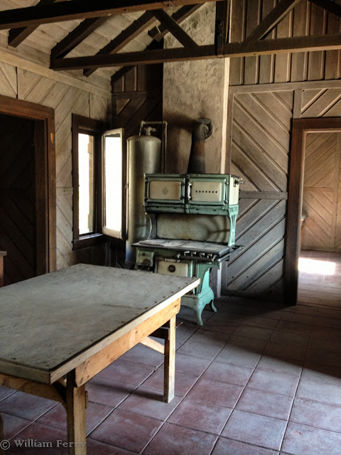
First a part of a large Mexican land grant, the town was founded not long after Alexander Duncan arrived in 1877 to began a sawmill operation. By the 1880s there were two hotels, a saloon, a meat market, blacksmith and livery stables and this general store.


With the lumber mill came the railroad. Duncans Mills became the funnel through which hundreds of thousands of board feet of redwood lumber were loaded aboard trains that followed the hills and creek beds down to waiting ships in San Francisco Bay.


For almost 60 years trains hauled freight (and passengers) to the the terminal in Sausalito. We sure don't think of Sausalito as being a railroad town, as trendy as it is now. The ledger in the foreground recorded the daily flow of rail traffic and the old fashioned phones at left kept the stationmasters in touch with each other and the outside world. It had to be a pretty busy place with three telephones.


Served by the North Pacific Coast Railroad and its unusually colored cabooses, the owners began building a narrow gauge steam line in 1874. It reached Duncans Mills not long after the mill opened. In 1902 new owners, at what must have been at great expense, transformed the track to standard gauge and installed powerlines to serve new electric engines. Redwood lumber remained the dominant item of freight. Since shutting down in in the 1930s, all of the right-of-way eventually became abandoned. The line stretched 93 miles to the Bay - what a wonderfully scenic journey it must have been as a passenger.


4.26.2013

SO THAT'S WHAT THEY DO


The Not-So-Secret Life Of Airstreamers


Just another tailgate party? Well sort of, this was just a small measure of mischief exhibited at an informal Airstream rally. 
The event was held near Duncans Mills which is on the Russian River in Northern California between Santa Rosa and the Coast.


There is an entire wing of Airstream owners who revere the vintage trailers (made 25 or more years ago). This man not only has a beautifully restored vintage trailer, he pulls it with an near vintage Buick. The motorhome with the awning out in the background is even an Airstream product.


There are cooks aplenty on potluck night - and mouths enough to eat near everything. This particular gathering drew about 100 people which translated into 55 trailers and a few motor homes. You can barely see the folks at the far end of the long line of tables.


Rally organizer Jeff is trying to see if this burro is interested in pulling an Airstream. 
The burro wanted to know instead if he could have a taste of the potluck and maybe a little wine.

4.24.2013

EEL RIVER


 It's A R'eel' Place 


Home to rock eating river serpents,


Herbivorous titans,


And home to a beautifully colored blue rock just waiting to be noticed.


A real bonus to our campground on the Eel was that we had the river to ourselves.
 It might have just been another place to layover but it was full of treasures to be found and shared. 


4.22.2013

Hello Confusion


Bemusement This Way


That would be one of the many signs directing you to stop at Confusion Hill, a long established roadside attraction in Northern California. Opened in 1949, this place has even achieved a "California Point of Historical Interest"for its longevity and quirky nature.


One of Confusion Hill's clam to fame is "The World's Largest Freestanding Chainsaw Carving", pictured above.


There is a 1.5 mile narrow gauge railroad that weaves in and out of the many redwoods and a "gravity" house which would probably be familiar to those of us who used to visit Knott's Berry Farm in Orange County, California..."Watch water run uphill"... you get the idea.


They have their own version of the Shoe House and many wooden sculptures including the cougar threatening an eagle perched above. 


For years what most of us paid attention to as we passed this area along Hwy 101 was the unpredictable hill above the road. You always wanted to check the road condition as the Confusion Hill Slide, as it was known, could spew rock down its face and shut the road. Today, with two new bridges, the highway twice leaps over a big bend in the Eel River to avoid the slide area. The benign looking face of rock at the far left of the image is left to crumble on its own.

The new bypass initially played havoc with attendance at Confusion Hill as traffic no longer drove past the attraction. Then noted TV travel videographer Huell Houser did a show on the place and that ended up helping them.


As I was walking away the spell of Confusion Hill befuddled me as I witnessed a caravan of virtually identical trucks passing over one of the new bridges. How do it know???


4.19.2013

FLOWING SANDS


Shifting Light


This was not the only photographer out at dawn to shoot the Mesquite Sand Dunes. 
I guess I shouldn't have been surprised by the several dozen shooters out early. I was one of them.


As the light changes, so does the color.
The little dots are other photographers that got up earlier than I did to climb out onto the dunes.


The geometry of a sand dune features ever changing patterns within patterns.


4.18.2013

A FOREST IN THE DESERT


Joshua Trees


So named as early Mormon emigrants saw, in the shape of some of these large yuccas, Joshua with his arms thrown to the heavens. Ranchers and miners used the sharp pointed leaves as fencing and the trunks for burnable fuel for early ore smelters. Even earlier inhabitants, Indians, used the leaves to make woven baskets and sandals. The seeds are edible.


Though not what you and I might typically call a forest, they do grow in groves. Healthy trees can often last 100 years and some have been found that are 1,000 years old. Root systems can spread 30 to 40 feet outward. Though there were no big yuccas visible here, they can grow to almost 50' tall. 

4.15.2013

FLATTER THAN FLAT


Racetrack Playa


Tiny as ants, these visitors are out on Racetrack Playa. Though "playa" is Spanish for beach, in geology it means the flattest possible natural surface. This is also a near-permanently dry lake.


What the surface of Racetrack looks like up close.


In the middle of this 2.5 mile long oval is this excretion of rock called, what else but, "The Grandstand." The day I visited I was surprised to find rock climbers tethered to a boulder or two. 


There is only a 1.5 inch differential over the playa's entire 3 square mile surface. You may have read about "mystery rocks" that move and leave tracks across the playa without human intervention. Best educated guess comes from NASA. Winds are very strong in this narrow valley. When an infrequent rain hits the playa, it turns the hard pan into shallow silt. Stiff winds follow and can move the stones across the surface and cause the weight of the rock to carve its path on the playa.


4.12.2013

SO THAT'S WHERE THE NAME CAME FROM


Teakettle Junction


This colorful bit of remote humor is in nice relief from the starkness that is Death Valley. 
Teakettle Junction is on the way to the Racetrack - which is the next stop on the blog too.


4.10.2013

UBEHEBE CRATER


Death Valley's Volcanic Past


No matter where you stand it is difficult to convey the size of the bowl that is Ubehebe Crater. 
This volcanic eruption is relatively new - just 2,000 years old!


The crater does show its age in a different way. 
Pronounced as it looks, U be he be, each layer of rock represents several millions of years in the building of the earth's crust.


This Google Earth screen capture conveys a little bit better the size. 
It is one-half mile wide and over 700 feet deep. Other volcanic eruptions are visible as well.

4.07.2013

MOSAIC CANYON


Marbleous!


Like a multilayered wedding cake, Mosaic Canyon is a confection but one made of stone.


In places the rock looks rough and brittle. Adjacent deposits though are hard and as beautiful as some of finest Roman marble. 900 million years ago magnesium rich limestone deposits (called "Noonday Dolomite") were laid down then buried deep. The depth also produced great pressures and temperatures that caused the limestone to metamorphose into marble. Tectonic forces pushed this remade material to the surface and you can see this unique layer in the canyon.


It doesn't take long to hike up Mosaic Canyon to see its wonders. 
The trip back down features a different beauty as the distant desert floor commands your view.


Inhospitable as this dry canyon first appears, there are pockets of hardy greenery. Spiny and waxy, this Rock Nettle somehow thrives and survives. Despite its thorny appearance, blossoms are pleasingly fragrant.


4.04.2013

SCOTTY'S OTHER "CASTLE"


Where Legends Really Reside


A man's home is his castle, or so it is said. Not for Walter Scott, the "Scotty" in Scotty's Castle. When the gates were closed, Scotty didn't bunk down here if he could avoid it. For many years Scotty was whomever other people wanted him to be: a cowboy in Buffalo Bill's Wild West Show; a huckster, verging on the criminal, for low-grade mines and finally, entertainer for eccentric Albert Johnson's guests. It was Johnson's vision and money that built Scotty's Castle. The real Scotty was an ornament.


In some respects Albert Johnson was an honorable man and more than likely became one of Scotty's few real friends. Johnson built not only the Castle but also the house that Scotty got to live in and finally be himself.


Unusually plush for a simple desert structure, considering it was built in the late 1920s. It was constructed with 2x6 insulated walls and clad inside and out in redwood. Scotty's real home was truly his castle.


Here he could be himself. And that self was a slob, as this one of many historic photos indicates. The National Park Service has obviously cleaned things up. The tour is not often offered. Indeed there were only 3 of us that met the ranger for the mile hike to Scotty's home.


Both the Castle and the cabin share the same method of fencing that has been in place for almost 100 years. The wire fence has never had to be replaced as rust is held in check by the remarkably low humidity and lack of rain. The fence also surrounds both properties. The "S" & "J" stand for Scott and Johnson. From the hills behind that fence springs give up 420 gallons per minute. That's what the fence protected.


With the same fencing as mute evidence in the background, our guide, Ranger Scott Combs, shows how Albert Johnson defused the barricading of the water supply for those who once lived or ran animals in the area. He built the stone structure visible in both the photo and behind our guide. It was a catchbasin for a water pipe that delivered water to those outside the fence. That is Walter Scott and Albert Johnson by the cistern.

At one time, Johnson and Scott cleared a 5 acre plot and for one season planted and harvested alfalfa in order to meet government requirements for homesteading the land.


Characters and charlatans come and go, but what is almost ever present is the animal life that surrounds us, all the more remarkable in Death Valley. The National Park Service chooses not to use traditional bait (which may kill other critters) but rather the lure of a nesting material (cotton). Our guide told us that in three years giving this tour in the Park, he's never seen a trap sprung.


4.01.2013

FENCE GALLS


AKA: Cyclone Galls


This is only the second time I've seen this phenomena of galls growing on fencing. Biologists say it is a little understood feature of nature. They are thought to be caused by insects interacting with the metal in the fence. In some cultures, the galls are a food source. Often the galls are used as a host to larva. Due to the time of the year these are seen, the insects that caused this anomaly are called April Foolish Buggers. Keep smiling and pass it along.