Pages

11.10.2012

KITTY HAWK

Where Man Took Flight


Certainly Kitty Hawk lived up to expectations. It is a marvelous shrine to what was a uniquely American event (though other nations were trying). As interesting, the outdoor shots you see above and further on do not depict the conditions that existed in 1903. Kill Devil Hill in the background was once barren sand, as was all the grass areas. Kill Devil was 125' closer in. Over time the constant northern winds pushed the hill south. When it came to build the memorial in the 1930s, Bermuda grass was planted to hold everything in place. 

This fragile looking stick and canvas motorized craft was the first air machine to get off the ground. The Wright brothers were very thorough experimenters and they even built one of the earliest wind tunnels to test aerodynamic shapes. They spent several years leading up to the December 17, 1903 date using the hill for glider launches.

The first powered flight nearly 110 years ago actually started well down the hill where the sidewalk appears to end. Note the positions of the small gray markers in the background that begin at that vanishing point.

This is a close up of what you saw in the previous image. There is a large granite stone to the left of the Wright brothers shop and living quarters. This is where the first series of successful flights took off that day.  Three more smaller monuments are visible to the right of the the larger one and mark the distances of the first three flights. The last flight of the day was real proof that man could fly as it went on for 59 minutes and covered 852 feet. 

How do we know all these facts and figures? Simple, Orville and Wilbur were very aware of their potential place in history and had witnesses including someone there to squeeze the bulb trigger on their camera. Both the resulting photograph and the eye witnesses served them well later as they became involved in a dispute with the Smithsonian Institute. The Institute wrongly believed that their staff were the first to fly.

This is the Wright Brothers Memorial at the top of Kill Devil Hill. There is a revealing 360 view of the surrounding countryside from here.


Even kids can play on a sturdier replica of the Wright brother's plane. That is a new school complex behind the playground.

On our way out and back from Kill Devil Hill our driver/guide took us through some of the beach area housing that had been hit by Hurricane Sandy. Up until a day or so ago sand had covered this road, too. There was still much sand piled around many of the beachfront homes making them inaccessible.


11.08.2012

HAMPTON ROADS 3

Connecting With Nature

This Brown Pelican came along side to check us out. We would later see flocks of them swooping and diving in the wake of our boat. Our passage over shallow waters would often kick up something they could nab.


Everything else of size has to sail back north to exit the city. Not us. The Intracoastal Waterway (ICW) allows us and smaller craft to avoid the Atlantic Ocean and stick to the backwaters. The transition from urban to rural was surprisingly swift.

Cormorant Clutter

Though Norfolk dropped behind us quickly there were isolated reminders that the Navy has many tendrils reaching out past the port. Best guess for this location is that the buildings are Navy ammunition bunkers.


Dead end? No, but it marked a short stop for us at the Great Bridge Lock, the only lock on the ICW.


The lock makes neighbors of us all for about 15 minutes. Captain Snyder has a feather touch on the controls as he snugs the edge of our ship up to the tie up bollards. Take a quick look at the powerboat on the right. Do you see the furry speck that caught my eye?

Emerging from around the starboard side comes the resident cat. Guess it makes more sense to keep a cat than a dog on board.


Not at all what we expected - this run of the ICW resembled a Louisiana swamp. Indeed this manmade canal runs through the appropriately named "Dismal Swamp. As foreboding as it looked, the swamp was once home for runaway slaves.

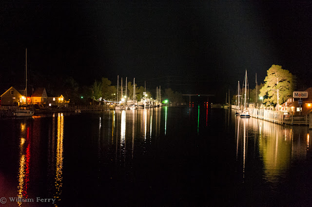
Our moorage for the night was at Coinjock, NC. The place is not on many maps and probably familiar only to those using the ICW. The little store there capitalized on its pint-sized reputation by selling T-shirts that read "What Happens In Coinjock, Stays In Coinjock." This flyspeck sized place is thought to get its name from the Indian name for mulberry.


11.07.2012

HAMPTON ROADS 2

More Than Just A Navy Town

These beautiful bricks lined a portion of the "Cannonball Trail", which is a meander through parts of old and new Norfolk. 


A Mix Of Old & New
One stop along the historic walk was at this Civil War monument. Apparently Norfolk was also the site of the annual reunion of veterans. The plaque on this face of the obelisk dated 1951 commemorated the "The 61st and Final Reunion of the UCV". UCV were the United Confederate Veterans. 


The Hunter House Museum. Built in 1894 by James Wilson Hunter. He came to this city as an orphan and built a small empire. None of his 3 children married and so the last one deeded the family home to the city to be operated as a "as a museum and example of American Victorian Architecture". All furnishing and fixtures were left intact.

This is a portion of St. Paul's Episcopal Church. Besides the building being notable for being the only colonial era building that has survived the many sieges laid on the city, it is also the final resting place of a cannonball fired in 1776 during the Revolutionary War. It is easily visible in this image.


Looking like an artistic accent, this mermaid is actually one of many that we spotted along our walk. 1999 a local attorney started "Mermaids On Parade" it was a big hit with the whole community.


Norfolk's mermaids all have names. This one is called Lola. 


The sun was never much in view while in port so this sunrise color was nearly all we got. The large white shape towards the left of the picture moved very quickly. It overtook us as we came into Norfolk and docked before we arrived. It was the Norwegian Dawn.


11.06.2012

HAMPTON ROADS 1

Norfolk: The Navy Owns It


Not much space for words but lots of room for big ships. Above and below is the retired battleship, the USS Wisconsin, now a museum in Norfolk. 
Looking straight on, its 108' beam gives no clue to its 887' length. It's sleekness contributed to a top speed of 28 knots (or 32 mph).


One of the first ships to be seen this day as we entered Norfolk just after dawn was being refitted: the USS Abraham Lincoln. They are prepping her for a nuclear reactor overhaul. As massive as this ship is, at the waterline it is only 26' wider and 156' longer than the much older Wisconsin.


At one point on our slow crawl along the Navy base's waterfront, it seemed that all you could see were Navy vessels .

Not every power unit at dockside is a boat. You have to wonder in the Navy's far flung kingdom where these shrink-wrapped locomotives are headed. Certainly the rail line code "EMBX" spray painted on the plastic should be a clue the name of the line but online I couldn't easily match those initials with a rail company.

This is the Arleigh Burke in dry dock. The keel was laid in 1988 and commissioned in 1991. Note the 4 turquoise colored objects being delivered to the ship. These are not high tech electronic devices. They are a gang of four, clean, porta-potties being delivered to the Burke. It makes sense that while in dry dock none of the ship's plumbing would be of use for those working on the ship - hence the periodic removal of the fouled heads with clean ones. I know, more than you ever wanted to know about this crap.

The last vessel is unnamed or at least no numbers have been painted on. The lines of the ship look like the same class of ship as the neighboring Arleigh Burke. This ship has several years ahead of it before it can be commissioned.

11.04.2012

On The Water

Baltimore & South


No, not our cruise ship but rather the USS Constellation. Built in 1854, it was the last "sail only" warship built by the Navy. During the Civil War, the Constellation spent much of it's time in European waters as a deterrent to Confederate raiders sent to hijack cargoes to the south. While I was there a contingent of midshipmen from nearby Annapolis were visiting the ship.

Our cruise ship, the American Star, is only partially visible as the bow area is peeking out from behind the old sailing ship


Not quite a view from the bridge, this is the lounge where we'll be spending a fair amount of time over the next few weeks. We have a historian/naturalist on board who will be giving multiple talks throughout our days on board. Every evening about 5:30 there is a forced march to this lounge for cocktail hour.


This is the dry bulk ship "Alpha" unloading raw sugar at the Domino sugar factory.

Upon reflection I shouldn't have been surprised by the industrial strength of Baltimore's spacious port but I was. Due to the extreme protection afforded from the tidal reach and winds of Chesapeake Bay, this is where our cruise ship took shelter during Hurricane Sandy. We heard there was lots of cutthroat bingo that went on during their forced layover. We're praying for better weather the next few weeks.


Though we are over 100 miles away from Norfolk and the navy base there, scattered throughout out the Chesapeake area are any number of the Navy's Merchant Marine Fleet. These two, with several others nearby, seemed semipermanently moored. Others down in Norfolk were in a more active area of docks. The two above are called "Roll On, Roll Off" freighters. The huge apparatus at the stern of each ship are ramps that can be positioned to load most any kind of mobile military vehicle from jeeps to tanks and anything in between.


The Chesapeake Bay Bridge has a longer, politically connected name but we aren't going to introduce any more politicians, dead or alive, to you especially so close to the election. Suffice it to say that this is one of the worlds longest over-water spans at almost 4.5 miles in length. When the original single span bridge was opened in 1952, heavy traffic was an almost immediate problem. Also suffice it to say that the politicians had to explain that they hadn't counted on so many people wanting to use it. The second span was added in 1973. Like the Golden Gate Bridge, this bridge is under constant upkeep, which accounts for all the scaffolding and shrouds on the original span at left as they maintain all that weather beaten steel.


Looking like heavy traffic of a different kind, this was the sight that greeted us as we exited the Baltimore sound area for the larger Chesapeake. Though several ships are underway, all the craft that are sitting with their bows pointed into the wind are anchored. The speculation was that Hurricane Sandy had so delayed the normal arrival and departure of these big behemoths in and out of Washington and Baltimore, that these ships had nowhere to go for awhile.


11.03.2012

Washington To Washington

There's A Difference?

When airborne it's always a toss up for me - do I read a book or look out the window. I try to do both. Though Ivan Doig's "Work Song" is one of the finest books I've read in a long time, I don't get the opportunity to gaze at the land that unspools below the window very often.


Mt. Ranier was visible until we climbed above the ceiling. Mt. Hood is the is just to the right of Ranier and that is Tapps Lake in the foreground. We are leaving Washington St. for Washington, DC


Fresh snow on the eastern front of the Rockies where they meet the High Plains at left.
Clouds on clouds on clouds, somewhere over the Midwest.


If we hadn't seen the Washington Monument as we landed, below, I would really have wondered just where we did land. 


Regretfully we are going to have to forego doing anything more touristy than just look out the window as we make a quick transition from the DC area to Baltimore.

11.01.2012

Detour

Seattle


 Room With A View

Everything was in motion and all systems were go. Bags were packed and we were headed North then East. Then that storm with a friendly sounding name but a rabid reputation, Hurricane Sandy, made a mess of so many plans. Our plans were small potatoes compared to the lives that were disrupted, or worse, ended. But still, we were lucky to be just inconvenienced.

Instead of spending 4 days exploring Washington DC, we got reacquainted with a place that we hadn't seen in quite a while - Seattle. Further turning that sour lemony taste into lemonade was the room we got overlooking one of Seattle's most famous landmarks.


Seattle is a much more colorful city than its skies let on. At left a tree that could be mistaken as something from Vermont. Monorail tracks split a portion of the EMP (formerly known as Experience  Music Project) Museum Building. 


Guess what was 50 years old this year? 
Yup, the Space Needle. Still going strong and still as beautiful as ever. 


What is Robin doing? Well, given that it was Halloween when we met her, her appearance is only part of the story. Robin was at the Seattle Center to welcome us to a fantastic exhibit about legendary King Tut. Subtitled "The Pharaoh's Gold", it was certainly colorful and rich in history.


This gorgeous urn held the remains of King Tut's stomach. Seems there were funerary urns for many other parts of his viscera as well as his sarcophagus. These objects were over 3,000 years old. Some we saw were from 5 millennia ago. Not sure I've seen many objects that old.


This is what King Tut looks like today. This is the only model of his body. It was done with scanning equipment that then produced a 3 dimensional image that was made into what you see above. The king was estimated to have only been 19 when he died.

As observed we saw a bit of the city during Halloween. The lady on the left was actually a pretty young woman who assumed the costume of something out of Mary Poppins. The cute girl on the right was a little kid who was waiting for her porridge.


Good food is almost as common as the rain here, even in many delicatessens. Me? I was happy with a brown bag lunch with a soda whose label I hadn't seen for years.


As colorful as Seattle is, not all color is wanted. We did see more graffiti than before and there appear to be many more panhandlers. One guy tried to be clever with a sign that said: "Give me money or I'll vote for Romney." He'd starve in my home town.

One last note, every photo was taken with an iPhone.